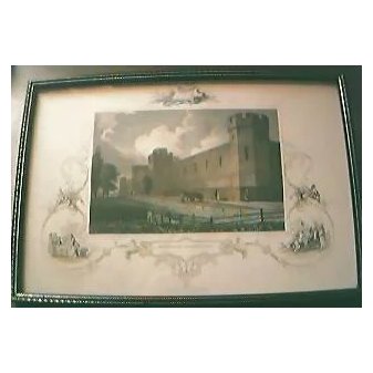
Antique American Engraving "Penitentiary, Philadelphia" Circa Early - Mid1800's
This is one of a set of 6 of these hand-coloured early American engravings published by J & F TALLIS of London & New York. Each has beautiful Vignettes around the borders and are quite stunning. Each has been professionally cleaned and had foxing removed and consequently are looking marvelous. Measurement is 11" x 7 1/2". Frames not original.John Tallis is considered to be one of the most renowned cartographers and publisher of the 19th century. His work is considered to be the last of the lavishly decorated and ornamental maps. They are works of art as much of geography. John was born in Stourbridge in Worcestershire about 1818 and it is possible he stayed working in the Midlands as a publisher in Birmingham, until he moved to London in the early 1840′s. He set up the first of his publishing businesses in Cripplegate, with Frederick Tallis, who was quite possibly his brother. This business lasted from 1842 to 1849 when it was dissolved. By 1846 the business had moved to Smithfield. From 1851 – 54, John set up another business, operating as John Tallis and Company and it was during this period that he produced the Illustrated World Atlas, produced for the 1851 Great Exhibition. The intriguing thing is, that at some point, John Tallis made the acquaintance of an engraver named John Rapkin who was an inspiration to Tallis. His stunning illustrations enabled the maps they produced to be beautiful illuminative works of art.John Rapkin’s work inspired John Tallis and they used travelogues extensively to guide John Rapkin as he produced vignettes and ornamental engravings to embellish the Tallis maps. The maps were surprisingly uncolored, although when sold colorists were frequently employed to add tints to them. Tallis' maps represent the end of an era in the production of grand decorative atlases. Tallis is known for his series of small illustrations or vignettes, depicting foreign scenes which are sensitively arranged around the map itself. Tallis maps supplied the great desire for foreign exotica that was in demand in the mid 19th century. With his brother Frederick, the Illustrated Atlas of the World was published in about seventy parts between 1849 and 1853.
Note: Checkout will occur on the merchants website, and will open in a new browser tab.
Molloy's MEGA Antiques
+64 09 4887326
122 Anzac Street, Takapuna, Auckland 0622
This business has been trading for 9.0+ years on Website Worlds eCommerce platform!
Categories: Art (213)
Other products you might be interested in
14/386 Richmond Road, Grey Lynn, Auckland 1021

